Showing posts with label Land Use. Show all posts

Monday, March 26, 2018

Evangeline Corridor Initiative - Your comments are due March 29, 2018

From page 14, ECI Final Report, March 9, 2018.

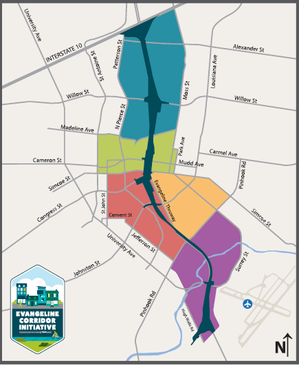
The Evangeline Corridor Initiative or ECI (formerly called the TIGER grant initiative) began over 2 years ago when the Lafayette government received a planning grant from the Federal government of $300,000, and matched this with an even larger local tax match. This planning effort is deeply intertwined with the Lafayette I-49 Connector's own tens of millions of tax dollars spent for planning. The ECI is now coming to an end, and it is time for the citizens to examine and comment on what we the taxpayers and residents got for our money.

The Evangeline Thruway Redevelopment Team (ETRT) at its March 12 meeting, accepted a draft Final ECI Plan and recommended the plan be made available for public comment. Two public "open house" style meetings (that is, public meetings where the public informed but is not invited to publicly speak) were held on March 21 and 22 to provide the public with information about the Evangeline Thruway Redevelopment Team (ETRT) plans for our community in the area surrounding the proposed I-49 Connector.  You can read more about the ECI through their web site which redirects you to their Lafayette Parish government page: www.evangelinecorridor.com

At these March open house meetings, representatives from Lafayette Consolidated Government, the ECI's professional consulting team, and the ETRT were on hand and were available to answer questions from citizens one-on-one. The 175 page ECI draft Final Report/Action Plan is available in print at the Rosa Parks Transportation Center at 101 Jefferson Blvd. To download the Report to your device click here. Public comments on the report are due Thursday, March 29, 2018 at noon. I urge every Lafayette citizen to examine this draft report and other materials from the ECI web site and submit their own comments on the draft plan. You may also comment on other relevant issues that should have been addressed in the study. In order to comment, you may
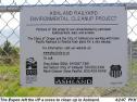
  1. Have left a written comment at the meeting (see the image of the ECI  comment card below).
  2. Fill out and mail or hand-deliver the ECI comment card which is available in pdf format by clicking here.
  3. Or, simply email comments to ETRT@lafayettela.gov
Don't forget, the deadline for comments on the draft final report is noon on Thursday, March 29!


After submitting my own comments to the ECI, I will publicly share them through an update or comment added to this post. After you submit your comments, you may also publicly share your ECI comments by copying them as a comment at the bottom of this blog post.

Thanks to all who provide their input on this plan.


----------------------------------- COMMENTS BY M. WALDON -----------------------------------
Note to readers - because I included a photo in my comments I must add them here as a blog update rather than simply making them a blog comment. To view other reader comments click on the word "comments" at the end of this post.


These comments related to the March 2018 ECI Open House Meetings and the Draft Final ECI Report. They are submitted by Dr. Michael G. Waldon, 110 Seville Blvd, Lafayette. I live in City/Parish District 3. I do wish to thank the ECI team for consideration of my concerns.

 
GENERAL COMMENTS

Relationship to I-49 Connector
A relationship between this TIGER Grant and the Lafayette I-49 Connector project clearly exists, but is unclear. I do see in provided documentation that this TIGER project, now termed the ECI, is considered a mitigation for the damage to the Corridor from the I-49 Connector project. I submit this comment addressing the ECI draft final report in the larger context of the I-49 Connector itself.

There is very strong opposition to the I-49 Connector throughout Lafayette Parish, and this opposition is particularly intense within the ECI corridor. There have been hundreds of citizens who have attended meetings to voice their opposition to this project. Opposition has been intense for a very long time, at least since the first EIS was presented almost two decades ago. Now, the ECI planned projects are presented as a carrot in a final desperate attempt to lure opponents into grudging support. This strategy will not work!

The public is not so foolish that they will believe that suddenly a district that has seen neglect for a century will suddenly become a target for local expenditures. The truth is that nothing in this plan is funded, and no funding mechanism has been identified. We see that the local government can’t be bothered to even maintain the property they already have within the Corridor. Why should we believe that the parish will suddenly have funds for new playgrounds in pocket parks, or even have money to keep the grass cut. Put simply, we are on our own. The I-49 spector reduces property values for Corridor homeowners today, and if it ever is funded for construction, it will destroy these communities and turn them into urban deserts. 
In supporting Lafayette’s application for additional millions of dollars of federal grant funds for continuation of the TIGER project, one councilman responded to our opposition to continuation of the TIGER funding at a Parish Council meeting. To paraphrase, he said that if we don’t spend the federal money someone else will. This hardly seems to be the prudent way we, the taxpayers, hope our elected representatives will spend our money. I urge all who are given the responsibility to allocate our tax dollars will use good judgement and spend our taxes as prudently as if spending their own money. Simply spending for the sake of spending? I say no! 

We have been assured that if there is strong local opposition the I-49 Connector (we call it the I-49 Con) will never get federal construction funds. If that is the truth, then the Con will never be built. 

Therefore, I conclude, the first thing to decide is - Will the I-49 Connector really be built? If yes, then drop all of these projects in the draft final report because there will be no community left to use them. And, if no - the I-49 Con will never be built - then we do not need the ECI. The Evangeline Corridor will bloom with renewed life if this spector of future destruction is removed. Property values will increase, private investment will return, and - note to our Council - tax revenues will grow. Let us hope that we stop spending federal money just for spending sake, and pursue alternative like the LRX, the planned Lafayette western bypass. 

My recommendation for the Final Report is to state early and clearly that the ECI report does not endorse the I-49 Connector, and that funding, construction, and maintenance of these projects is in no way dependent on the Con. Alternatively, state clearly that these projects are being proposed to mitigate the tragic destruction of our communities that will result from building the urban interstate through our city’s heart.

 
Pedestrian friendly
Throughout the draft final report I see the words “pedestrian” and “pedestrian friendly.” Sidewalks were not built so that utilities would have a place to put their poles! Before we pursue other pedestrian friendly ideas, we need to set a Parish-wide policy that new utility poles will never again be placed in our sidewalks or placed such that pedestrians or handicapped individuals in wheelchairs need to move into traffic to avoid the pole. Placing poles or other obstacles in our sidewalks is not only a safety issue, but also is a statement that pedestrians are valued far less than cars in our community. 


Hurricane Evacuation Capacity is Essential
Before, during construction, or after the vaporous I-49 Connector project is realized, the current capacity for hurricane evacuation must at a minimum be maintained on the Evangeline Thruway itself. If ever funded and constructed, the elevated roadway will provide limited resilience in the face of heavy rain and wind. As residents of Louisiana we know that elevated roads get blocked easily. High winds and rain preceding the storm may even force closure of the interstate to high profile vehicles like trucks. Hurricane evacuees often cannot buy gasoline because of long lines or loss of power. On a surface road, out-of-gas cars can more easily be move out of traffic. However, experience shows that long bridges are often blocked by out-of-gas cars. 
This is very relevant to any ECI plans along the Thruway. Until the surface level western bypass, the Lafayette Regional Xpressway or LRX, or other bypass is built I would not support any changes that “calm traffic” or reduce roadway capacity on the current Evangeline Thruway. 


City property
I commend the City/Parish leaders for showing an interest in the Evangeline Corridor area of our city. The neglect that this area has experienced in the past is clear. A recurring comment by residents at meeting that I attended was the lack of simple maintenance of city-owned and LUS property in the Corridor. The city seems unable to regularly mow the grass and keep up the appearance of their property in this area. This not only contributes to a blighted appearance, but also, right or wrong, makes us think that the residents of this area of Lafayette are less important to the powerful interests in charge of the city. Only now, when a plan to further destroy these communities with a six lane urban interstate through its heart do we hear of highway administration funds giving us unfunded plans for new projects. If you can not cut the grass and paint your fences, why should the public believe any of these dreams will ever be a priority? 


Here are examples of properties which are not properly maintained:


  • LUS Water Well #10 on Moss St at Park is no longer in production and has been described as abandoned (see attached photo).
  • The abandoned Grant Street Power Plant is unsightly and a public hazard from contamination.

At the meetings, residents gave a number other examples with which I was not familiar. In summary, the ECI draft final plan seems hypocritical when we see the apparent neglect received for care of City properties within the corridor. 


LUS Well 10 at Moss St at Park is abandoned and clearly looks the part! The photo is also available at the link https://goo.gl/f21aZn


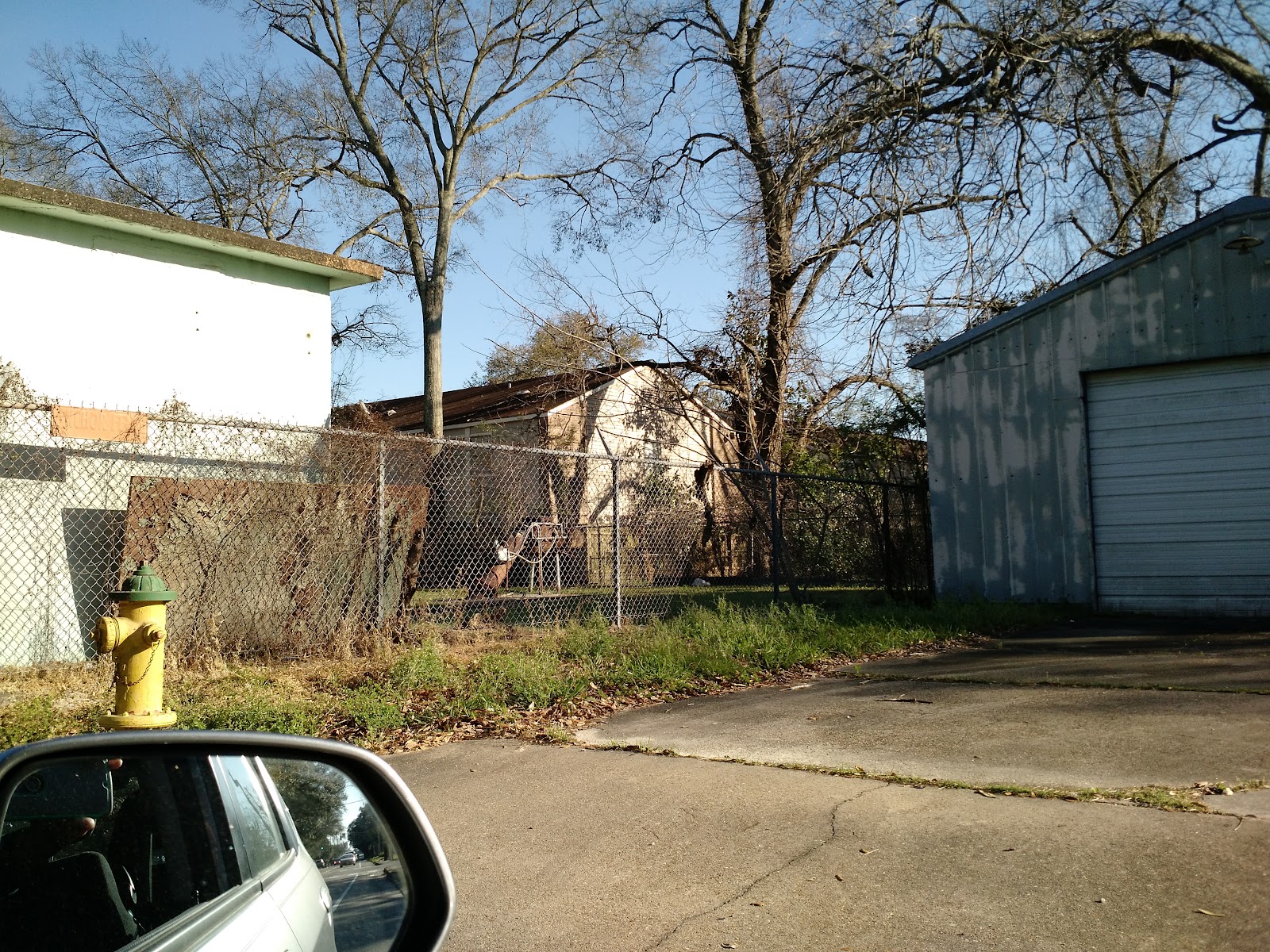
PROJECT SPECIFIC COMMENTS


Iconic Structures
Throughout the I-49 Connector discussions and resident protests, we have heard of plans to build an ill-described bridge to signify the progressive nature of Lafayette. This seems to have moved forward and influenced the proposal for a Gateway Feature (project Gateway B). First, this is an idea that is ripe for ridicule. It is hard to see why the LCG and DOTD would provide such an opening in a community that can’t even fund a school tax. Tax opponents will use this as a hammer to destroy the whole ECI and Con programs. Second, we already have a beautiful gateway structure, our visitor center. We need a gateway that embodies Cajun and Creole culture, not a steel bridge or weird art. Those are fine for other places, but people visit us for the culture, and the current visitor center represents us very well. I am deeply saddened that DOTD plans to destroy the current center, and have been told that replacement will need to be at Parish taxpayer expense because we should have known better than to build it at its current location! In summary, rebuild the visitor center if the I-49 Con is ever built, and otherwise no iconic structure is needed.. 
 

Clay quarry
We have noticed that you plan to put a new park (project Gateway E) at what I believe is the old Clay quarry near the historic Lafayette brickyard and clay quarry (see The Attakapas Country: A History of Lafayette Parish, Louisiana by H. L. Griffin, p 52 and further) . This site is historically important in Lafayette. It is my understanding that most of the bricks for the old buildings in Lafayette came from this site. After the quarry was abandoned, it became a swimming hole for many of the young people in the city of Lafayette. The cool water that flowing freely from the now unconfined artesian aquifer must have provided cool recreation on hot days for many youth. However after two children drowned the council decided to fill the quarry. I am told that any fill materials that were available were used in filling the quarry including waste, trash and garbage - any sorts of materials that were no longer wanted. Today it is likely that this site not only provides contamination to the underlying aquifer and our water wells, but also may be a health hazard to nearby residents. Caution should be exercised in building a park at this location. 


Pedestrian bridge near Surrey Street
A pedestrian bridge near Surrey Street over the Vermilion is needed, and I am in firm support of the bridge proposed in the draft final report (project Vermilion E). I cannot recall ever crossing a less bicycle and pedestrian friendly bridge than the Surrey Street Bridge. Crossing on foot, I look up and down the road, then run as fast as I can to get across (tough job for an old man like me). There is absolutely no room for a pedestrian on this bridge if there are large vehicles passing at the same time. Do children attending the nearby Paul Breaux Middle School have to cross this bridge? I was thrilled to see the idea of a pedestrian bridge near this site suggested in the ECI report. I strongly support this idea.


Again, I thank the ECI team for the opportunity to provide public comment.

Monday, April 3, 2017

Contamination of our Chicot Aquifer: April 3, 2017, CCGG Meeting


The Concerned Citizens for Good Government (CCGG) held its regular 1st meeting of the month on Monday, April 3, 2017 at Alesi’s Pizza House in Lafayette, LA.  Guest speaker was Michael Waldon, PhD, and retired licensed professional environmental engineer. The title of the presentation was: Contamination of our Chicot Aquifer.  What do we know? How do we know? What should be done? WaterMark Alliance spokesperson Kim Goodell also gave an update to pending litigation and the I-49 Project. As always, there was an opportunity to ask pertinent questions at the end of the presentation.

If you missed the meeting, you can still participate. Click the following links to learn more about the meeting"

Additionally, you can still participate by sharing to Facebook or other media using the share buttons below, and by adding your ideas and questions in the comments section. If you feel strongly about the issue, please contact our political leaders. Our local leaders' contact information is available by clicking HERE.

Thursday, March 2, 2017

Why are there high levels of arsenic in some Acadiana soils?

Figure 1. "4 Sources of Arsenic You’d Never Expect"

Introduction - The issue of arsenic contamination may at first appear to fall outside the scope of I-49 Connector (The Con) questions. However, arsenic contamination of our soils is an issue that does intersect with The Con's issues. In this post I will give some background about how elevated arsenic came to be in our parish soil, how it can impact us, and what we need to do about it.

If you recall the periodic table from your school days, arsenic is chemical element number 33 with the symbol As. Arsenic falls in the table just below phosphorus in column 15, and this means that arsenic may react in ways that are similar to phosphorus and disrupt some chemical reactions that are essential to life.

Sources of arsenic contamination - Arsenic was used for many purposes in the past, but is much less widely used today. In the southern US, arsenic pesticides in the form of lead arsenate dust and other formulations were regularly used on cotton crops to control boll weevils prior to the development of organic pesticides like DDT in the middle of the 20th century (Figure 2).
Figure 2.  Dusting cotton from"A is for arsenic" Wired 6/19/2012

Figure 3. "Arsenic and Old Railyards" F. Harrison
Along side sugar cane and livestock, cultivation of cotton provided an economically important income for Lafayette farmers since the earliest days of our town then named Vermilionville (Griffin, 1959).  Cotton farming has now come to an end in Lafayette Parish (Soil Survey of Lafayette Parish, LA, 1916Soil Survey of Lafayette Parish, LA, 1977NRCS Web Soil Survey, 2017), but in many places the legacy of arsenic pesticide use remains in our soil. Today in Acadiana, many sugar cane and rice fields cover the ground where cotton once grew, and the legacy of arsenic contaminates our rice crops (C. Poterra, 2007; B. Goodman, 2011;  T. Greenaway, 2012Consumer Reports, 2012). Recent spreading of suburban development on our former cotton fields may also lead to routine but unrecognized exposure of Acadiana families to arsenic.

Arsenic was also used routinely in railroad operations to preserve rail ties and other wood, and to kill weeds along the right-of-way (MADEP, undated) so that engineers had an unobstructed view ahead and along each side of the tracks. Planned "rails-to-trails" projects have been complicated or even blocked by by the discovery of elevated soil arsenic levels leading to unanticipated clean-up costs (Ciabotti et al, 2004). The Rails-to-Trails Conservancy has published a compilation of case studies and guidance related to understanding contamination issues (Ciabatti et al, 2004), and the State of Massachusetts has recognized that repurposing of abandoned railroad routes poses a risk, and have published guidance in the form of Best Management Practices (BMPs) for the development of rail-trails (Massachusetts DEP, undated).

The railroad was completed to Vermilionville in 1880, and today continues to run through our city which is now named Lafayette. The arrival of the railroad connecting New Orleans and Houston brought jobs, growth, prosperity, and commerce to our city. Steam trains which burned bunker oil had limited range, and all trains passing through Lafayette had to stop for refueling and to take on water and sand. The Lafayette railyard grew to be a major facility employing up to 1000 workers and providing complete maintenance service for the early steam engines (Griffin, 1959). There is now concern that the downtown railyard which was abandoned in the mid 1960s (Louisiana DOTD Draft Phase I ESA, 2016) will contaminate the Chicot Aquifer and our municipal water wells (C. Taylor, 2016).

Arsenic contamination of old railyards and rail lines has been found across the US. The abandoned Union Pacific Railroad Ashland site in Oregon is likely typical (Harrison, 2008). This railyard has similarities in age and past uses to the abandoned Lafayette yard, but the Ashland site is roughly half its size and poses little risk to water supply wells or local groundwater below the surficial level. The UPRR-Ashland site operated as a locomotive maintenance and refueling station from 1887 until 1986. Also, in contrast to Lafayette, the UPRR is actively working to remediate the Ashland site.

Figure x. Cultural Thoughts
Health impacts of arsenic - Despite the fact that arsenic has been used as a poison for centuries, the more subtle chronic health impacts from long-term exposure were often not recognized in the past, to the extent that low doses of arsenic were often used as a medicine or tonic (Wikipedia-Arsenic Poisoning History). It is now recognized that chronic exposure to arsenic can cause many ailments including thickening of the skin, darker skin, abdominal pain, diarrhea, heart disease, numbness, stroke, diabetes, chronic respiratory disease, and cancers of the skin, lung liver, and kidney. There is no evidence based treatment for chronic exposure; therefore, management must be focused on reducing exposure (Ratnaike, 2003).

Arsenic standards, levels, and limits - The USEPA sets standards for allowable concentration of contaminants in drinking water. These are called Maximum Contaminant Levels or simply MCLs. In setting an MCL, EPA first determines what concentration of contaminant would cause no health effect, and terms this concentration the Maximum Contaminant Level Goal or MCLG. In setting the MCL, EPA considers the cost and practicality of treatment weighed against the public health risk for the specific contaminant. The MCLG for arsenic is zero, meaning that there is no minimum concentration below which there is no health risk. In 2000, the EPA initially proposed an MCL of 5 ug/L (micrograms of AS per liter), but considered other levels of 3, 5, 10, and 20. After comments were received and reviewed, the final and current MCL for arsenic was set at 10 ug/L with an MCLG of zero.

In the US, public water suppliers are required to test for arsenic and meet standards after treatment. However, many private wells may be untested and can be a significant risk to adults and especially to children. The short 10-minute film In Small Doses: Arsenic gives useful background information on the risks from arsenic and discusses the risk of arsenic exposure from private wells in New England.

Beyond the concern for exposure to arsenic through rice which was mentioned above, other foods can be a pathway for exposure and risk. A 2012 study by Consumer Reports provides much useful information. The FDA does not currently regulate the amount of arsenic that can be present in our food. However, Dartmouth University's Children's Health web site recommends that we should: (1) limit rice consumption, choose white rather than brown rice (2) limit apple juice consumption, drink other juices, or skip drinking fruit juice (3) read labels because rice sweetener in the form of brown rice syrup is used in many foods. Dartmouth also recommended always rinsing rice before cooking, but recent research reported by the FDA shows that rinsing rice before cooking results in very little arsenic reduction, but does reduce some valuable nutrients. Gardening on arsenic contaminated soil can present concerns. The Washington State Cooperative Extension has published guidelines for gardening on lead and contaminated soils (F. Peryea, 1999). One simple recommendation is to carefully wash garden fruits and vegetables to remove all traces of soil before eating.

In addition to arsenic exposure from food and drinking water, exposure from breathing contaminated air must be limited. For employees, OSHA sets exposure limits based on an 8-hour average concentration of arsenic in air. OSHA sets the arsenic action level at 5 micrograms of AS per cubic meter of air. Personnel working on the abandoned railyard property and along the rail line should take care to limit their exposure to contaminated soil and dust. Lawn mowing and weed control, for example, may produce dust contaminated with arsenic and other soil contaminants. And, it follows that the public needs to be assured that they are protected from dust blowing from these sites through careful management of all activities on the sites which may create dust leaving the property boundaries.

Monday, May 23, 2016

The Evangeline Thruway did NOT split our neighborhoods!

Let's look at the actual history of Lafayette. The railroad has been an important part of our city's development. By 1885, Lafayette had a full fledged railroad, and significant freight was shipping from Lafayette by train in the 1890s.  New residences were constructed as the railroad developed. However, the presence of the rail yard limited the connection between communities on its two sides. It was not until 1964, after the rail yard was moved to its current location between Willow and Cameron Streets, that multiple connections between the east and west were established. It was not until the 1960s, for example, that Johnston Street was extended to meet Louisiana Avenue across the abandoned yard.

So, when paid Connector proponents tell you that they are reconnecting our city, remind them that currently more than 30 streets connect east to west across the Thruway. None of the plans for the urban interstate development maintain this level of connectivity, much less increase it.
 
Reference: C. Ray Brassieur, Lionel Lyles, Michael S. Martinc, Freetown: As it was and as it is, The Freetown History Project Final Report, November 30, 2013, available at http://www.crt.state.la.us/downloads/HP/freetown/FREETOWN%20FINAL%20REPORT.pdf.

Sanborn overview map, 1940-1949.


Thursday, May 19, 2016

How big will the I-49 Connector retention pond be? Where will we put it?

Retention/detention pond behind the new Costco store in Lafayette, Louisiana.
photo credit: M. Waldon, no rights reserved


The Lafayette I-49 Connector project envisions a new 5.5 mile highway project going through Lafayette. Where will its storm water drain? The 2002 Environmental Impact Statement simply says it will drain directly into the Vermilion at its southern end, and into local drainage which flows to the Vermilion in its central and northern sections. Even in 2002, it must have been apparent that this could impact flooding. Today, we generally require retention/detention ponds to hold back flows from new construction so that no added flooding results from new projects. These ponds also reduce water pollution by settling out some pollutants How could this not be a major topic of discussion today?

Let's do a "back-of-the-envelope" calculation to get an idea of how large the pond or ponds must be. The project is 5.5 miles (29,040 feet) long, and average width is, I'm guessing, about 600 feet. Multiplying gives 17.424 million square feet of total project area. There are 43,560 square feet in an acre, and division gives 400 acres for the entire project area.

A big 3-day rain event in Lafayette can drop a lot of rain, and we need to plan for the really big storms to avoid flooding. At times we have gotten over 20 inches of rain in one day, so I will assume for planning that we get 30 inches in a 3-day event. Of this rain, some runs off, and some is retained or evaporates. For a typical residential, industrial, or open area, 20% to 60% of the rain might run off. Here, I will assume that 30% currently runs off to the Vermilion. For developed areas with significant impervious surface and sloped, compacted, and drained soil, 80% to 95% might run off. Here, I assume 85% runs off. So, 55% more of the rain is expected to run off after the project is completed. This is 16.5 inches (1.375 feet) of new runoff.

The total volume of added runoff is therefore 400 acres times 1.375 feet, or 550 acre-feet of water. Therefore, the pond needs to provide a storage volume of 550 acre-feet. If our retention pond has an average depth of 3 feet above the dry weather water level, then the pond must be 183.33 acres. Making room for shoreline and fence line (maybe even a jogging track), I assume the pond and related features will take up about 200 acres or 8.712 million square feet.  If square, this requires a property 2952 feet (0.56 miles) on each side.

Where in developed Lafayette can  we place such a feature? The pond must be downhill from the I-49 Connector to avoid the costs and uncertainties of pumping. Therefore, feasible placement of this pond is limited generally to the area between the roadway and the Vermilion channel. Further, any destruction of wetlands or residential areas should be avoided. Agricultural land might be an ideal choice, but we are unlikely to find such within the developed urban area within a feasible distance.

Thus, the question remains - How will we deal with increased flooding from the I-49 Connector? Will this be addressed by DOTD in their public meetings?

Saturday, May 7, 2016

Foreshadowing the Lafayette Connector: 'The Monster' - Claiborne Avenue Before and After the Interstate

Photo: The Historic New Orleans Collection
George Santayana is credited with saying "Those who cannot remember the past are condemned to repeat it." With that in mind, look at the history of destruction left by the Louisiana DOTD as they developed urban interstates in the 1960's. In New Orleans they proposed the Riverfront Expressway through the French Quarter and along the Mississippi River. Thankfully, the public outcry prevailed to stop the French Quarter section of interstate, but the Expressway was built through the Treme neighborhood over Claiborne Avenue in 1968.

Read more about this history of loss in this WWNO post titled 'The Monster': Claiborne Avenue Before And After The Interstate.  http://wwno.org/post/monster-claiborne-avenue-and-after-interstate

Plans for the Lafayette Connector date back to this era of urban destruction and social injustice. How can DOTD prevent the same destruction and injustice in Lafayette today that they brought about nearly 50 years ago in New Orleans?

Friday, May 6, 2016

Public-Space Transformations

On Wednesday, May 4, 2016, Jason D. Faulk posted a comment on Facebook: https://www.facebook.com/jasondelanedoubleyou/posts/10209013383668993
In the post, he cites an article in Business Insider titled "11 dramatic public-space transformations captured by Google Street View" which concludes that "cities across the world are becoming less car-oriented and more pedestrian friendly":
 http://www.businessinsider.com/amazing-google-street-view-changes-2016-5

Jason Faulk states:
Most dramatic are the conversions of a street in Minneapolis, and the covering of the open-air recessed freeway in Dallas. All of which beg: if Lafayette, LA wants to spend $700 million to $1 billion on a 5 mile freeway connector, what other potentialities for urban space, that creates value for human beings on the ground, in private and public spaces are possible?‪#‎Y49Lafayette‬ indeed.‪#‎LafayetteConnector‬

What other possibilities for use of this space were considered instead of the urban freeway planned in this project?

This Facebook post generated interesting dialog through comments. I request that DOTD provide a response to this post and its associated comments.