This blog seeks to collect, archive, and make available public comments on the I-49 Lafayette Connector project which might otherwise be overlooked. The goal of this blog is to establish a dialog about the I-49 Connector project.
Note that this is NOT the site for official comment on the Lafayette Connector project.
site http://ConnectorComments.org email info@ConnectorComments.org
This work is licensed under a Creative Commons Attribution 4.0 International License.
Saturday, May 7, 2016
Health Impacts Near Interstate Highways: More Connector impacts not considered in EIS
New research shows a link between heart and lung impairment and living near an interstate highway. This research further brings into question the propriety of promoting public use of areas in the vicinity of an interstate. A news report describing these findings was published in the Boston Globe on April 14, 2016. Follow this link to read the story
https://www.bostonglobe.com/metro/2016/04/13/new-evidence-dangers-living-near-highways/hVyqTnY4iyn9YRoNSwWtGI/story.html
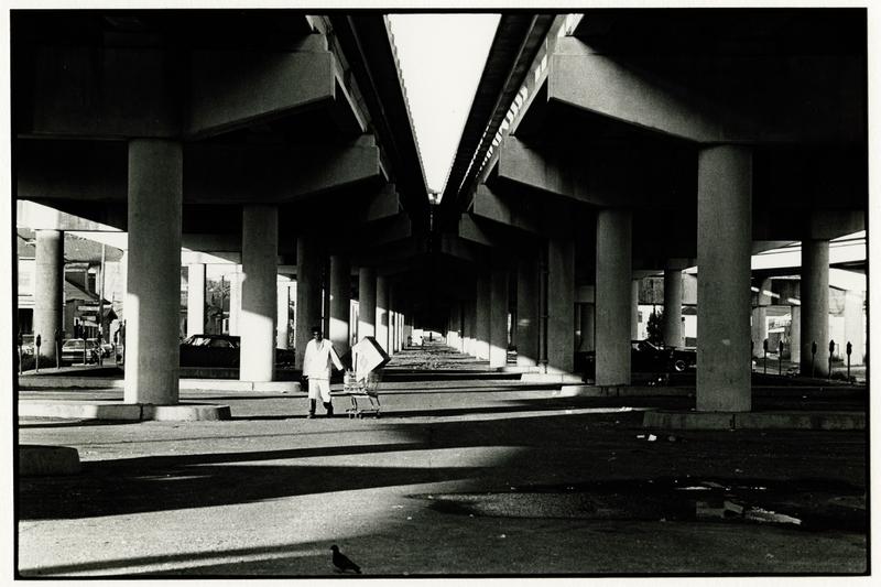
These findings bring starkly into question the Lafayette Connector Conceptual Design as displayed in their cover photo (above). Promoting pedestrian use, concerts, parks, playgrounds, and other recreational uses under and surrounding the elevated interstate is ill-advised if such activities may increase health risks. Indeed, the social justice of new urban interstate construction is questionable when findings show that residents living near interstates suffer health risks not shared by the rest of the community. Future use of downtown venues for public festivals and concerts will be jeopardized by the Connector.
Foreshadowing the Lafayette Connector: 'The Monster' - Claiborne Avenue Before and After the Interstate
| Photo: The Historic New Orleans Collection |
Read more about this history of loss in this WWNO post titled 'The Monster': Claiborne Avenue Before And After The Interstate. http://wwno.org/post/monster-claiborne-avenue-and-after-interstate
Plans for the Lafayette Connector date back to this era of urban destruction and social injustice. How can DOTD prevent the same destruction and injustice in Lafayette today that they brought about nearly 50 years ago in New Orleans?
Friday, May 6, 2016
Health Hazards from Toxic Construction Dust
How will toxic dust be monitored within and at the fence line of the Connector project?
How will the workers on-site be protected? Will all workers be required to wear respirators or other protective devices during construction?
How will the public, particularly neighborhood children, be protected from this hazardous toxic dust?
Loss of cultural venue the Feed N Seed
![]() |
The Feen N Seed at 106 N. Grant Street has marked for removal
by the Louisiana DOTD. Photo - M Waldon, no rights reserved. |
The article is available at:
http://theadvocate.com/entertainment/music/15690262-123/mike-dean-to-release-new-live-album-at-feed-n-seed-in-lafayette?fb_action_ids=10205025483350241&fb_action_types=og.comments
Earlier in 2016, a video recorded at the Feed N Seed appeared on NBC's Today Show:
http://www.theadvertiser.com/story/news/local/acadiana/2016/03/19/lafayette-featured-today-show/82012870/
To see more recent news, Google Lafayette Feed N Seed and click News, or use this link
https://www.google.com/search?q=Lafayette+%22Feed+N+Seed%22&rlz=1CALEAD_enUS617US618&oq=Lafayette+%22Feed+N+Seed%22&aqs=chrome..69i57j0l5.11996j0j4&sourceid=chrome&ie=UTF-8#q=Lafayette+%22Feed+N+Seed%22&tbm=nws
Public-Space Transformations
On Wednesday, May 4, 2016, Jason D. Faulk posted a comment on Facebook: https://www.facebook.com/jasondelanedoubleyou/posts/10209013383668993
In the post, he cites an article in Business Insider titled "11 dramatic public-space transformations captured by Google Street View" which concludes that "cities across the world are becoming less car-oriented and more pedestrian friendly":
http://www.businessinsider.com/amazing-google-street-view-changes-2016-5
Jason Faulk states:
What other possibilities for use of this space were considered instead of the urban freeway planned in this project?
This Facebook post generated interesting dialog through comments. I request that DOTD provide a response to this post and its associated comments.
In the post, he cites an article in Business Insider titled "11 dramatic public-space transformations captured by Google Street View" which concludes that "cities across the world are becoming less car-oriented and more pedestrian friendly":
http://www.businessinsider.com/amazing-google-street-view-changes-2016-5
Jason Faulk states:
Most dramatic are the conversions of a street in Minneapolis, and the covering of the open-air recessed freeway in Dallas. All of which beg: if Lafayette, LA wants to spend $700 million to $1 billion on a 5 mile freeway connector, what other potentialities for urban space, that creates value for human beings on the ground, in private and public spaces are possible?#Y49Lafayette indeed.#LafayetteConnector
What other possibilities for use of this space were considered instead of the urban freeway planned in this project?
This Facebook post generated interesting dialog through comments. I request that DOTD provide a response to this post and its associated comments.
Subscribe to:
Comments (Atom)


